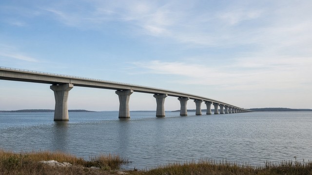
EASTON, MARYLAND — The Federal Highway Administration has approved Maryland's plan to replace the Chesapeake Bay Bridge with two new four-lane spans, completing the federal environmental review of the US 50/301 crossing that Talbot County drivers take to the Western Shore.
The Maryland Transportation Authority announced the approval Nov. 5. The combined Final Environmental Impact Statement and Record of Decision names Alternative C, with refinements, as the selected plan: two new four-lane spans, one south of the existing bridge and one between the current spans, with full shoulders, and removal of both existing spans. The five lanes on today's bridge would become eight. On the Eastern Shore, the transition from eight lanes back to the existing six occurs east of Cox Creek.
Anyone who wants to read the decision in person can do so for 30 days at viewing locations that include the State Highway Administration's District 2 Easton Shop at 8204 Elliott Road, according to the study website. The documents are also posted on the Bay Crossing Study website, and the authority lists 1-667-203-5408 for people who need help getting them.
The decision also starts a legal deadline. A Federal Register notice published Nov. 9 says any claim seeking court review of the federal actions on the project will be barred unless it is filed on or before April 8, 2027. If the federal law that authorizes a particular claim sets a filing period shorter than 150 days, the notice says, that shorter period still applies.
The Record of Decision puts the plan's cost at $14.8 billion to $16.4 billion without an optional bicycle and pedestrian path. The path would add $1.2 billion, for a total of $16.1 billion to $17.6 billion. The authority says it will run a financial analysis before deciding whether to build the path.
The authority expects to begin design in 2028 and construction as soon as 2032. The authority's Nov. 5 announcement also lists a proposed one-time investment of up to $40 million for transit-related improvements and a commitment for land preservation on the Eastern Shore, with no dollar figure or details given for the land commitment.
For drivers, the decision's traffic analysis finds that Alternative C would eliminate bridge bottlenecks on non-summer weekdays in both directions and on summer weekends in the eastbound direction. The authority also commits in the document to work with the State Highway Administration and local agencies on traffic along US 50/301 approaching the bridge, including the highway administration's US 50 from the Bay Bridge to Ocean City project. The highway administration's District 2, which covers Talbot County, oversees US 50 through the county.
The authority said it received more than 5,600 comments and survey responses during the study. The new spans would have 230 feet of navigational clearance, the same as the new Francis Scott Key Bridge.
Source: Federal Highway Administration
Drawn from public records; drafted with AI and edited by Peter Gorman before publication.
Comments
Signed comments are held for review, then published. Obvious spam is rejected before it reaches the editor. Letters and comments.
No published comments yet.